Atlantic Ocean Turbulence Trouble Spots - 00 UTC
About
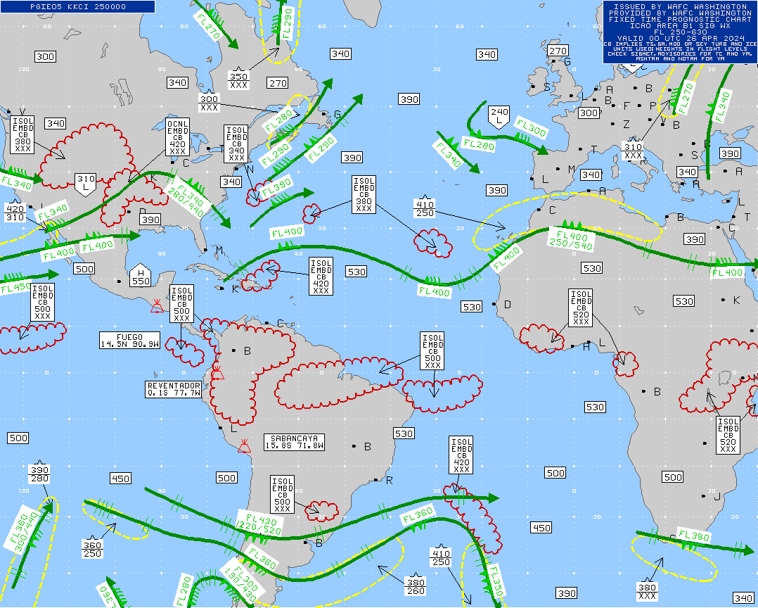
Dashed regions in light gray indicate possible moderate turbulence, while darker gray areas suggest severe turbulence. The numbers in the legend represent altitude ranges. A single hat symbol (^) denotes moderate turbulence, and a double hat (^^) indicates severe turbulence. Red areas highlight potential storms, which may also bring moderate turbulence. Black arrows indicate the jet stream, which can influence turbulence and flight routes. There are four maps available at any time, each valid for approximately six hours, based on UTC/GMT.
Maps brought to you by Turbulence Forecast. Worried about turbulence? Get a personalized forecast by email for your flight. You can choose to get a personalized briefing of turbulence written by an experienced forecaster, or order a custom AI generated map of your flight.